Map guide introduction
Locating spatial data can be difficult. Please don’t hesitate to contact Map Collection staff for assistance if you are having difficulty finding something in particular. This guide is not intended to cover all resources available, but rather list the most commonly requested and is regularly updated.
Other Maps Collection Guides -
- Guide to Victorian map resourcesA University of Melbourne Library guide to resources
- Aerial Photography ResourcesA guide to aerial photography resources for Melbourne and Victoria.
Need more assistance?
- Book a research consultationA librarian who specialises in your subject area will arrange an appointment to help you with your research.
- UniMelb Library Map CollectionThe Library Map Collection holds rare maps and geospatial data available to the research and education community. Access to hardcopy maps via the Baillieu Library Reading Room.
- UniMelb Map Collection Social Media accountOn the platform formally known as Twitter
Hard copy topographic maps
To search the holding of the Map Collection use the library catalogue limiting to titles in the Map Collection.
Hardcopy material from the collection can be requested and viewed at the Special Collections Reading Room, Baillieu Library.

Requests for duplication or copying services should be discussed with Map Collection staff.
Victoria
Victoria
- Vicmap catalogueVictoria's authoritative suite of statewide foundational spatial data.
- Vicmap ProductsVicmap™ is the foundation that underlies most spatial information in Victoria.
- Vicmap LiteStatewide data series depicting major features, public land, vegetation, hydrology, transport and administrative data.
- VicMap AddressVicmap Address is Victoria's authoritative geocoded database of property address points.
- VicMap AdministrationThis dataset series contains polygon features delineating key Victorian administrative boundaries.
- VicMap Transport - VariousVicmap Transport represents the transport network of the state of Victoria and is made up of point, line and polygon area features.
Road, Rail, Air & Water related infrastructure. - VicMap Transport - Road NetworkPart of Vicmap Transport - line & features. Includes; Bridges, Connectors, Footbridge, Ferry Route, Foot Tracks, Roads, Highways, Roundabouts & Tunnels.
- Public Transport. A collection of PTV datasetsPublic Transport Victoria bus, train and tram routes & stops depicts publicly known spatial the master routes in metro and regional Victoria.
- Melbourne Metro Tunnel Project & Stations GIS data packageThese spatial layers represents the location of underground tunnel and stations details for the Melbourne Metro Tunnel Project.
- VicMap Property (Simplified Parcel Boundary)Parcel Map Polygons is a polygon layer belonging to Vicmap Property Simplified, a modified and simplified model of Vicmap Property.
- VicMap PropertyVicmap Property consists of data representing Victoria's land parcels, properties and tablets representing Victoria's properties.
- Vicmap Hydro 1:25,000Contains line, point & polygon features delineating hydrology. A combination of a number of data sets that are a part of Vicmap Hydro.
- VicMap Elevation - 1-5 Contours & Relief (1985 Melbourne)Metropolitan Melbourne coverage, 1985.
- VicMap Elevation 10-20m Contours (Statewide)This layer is part of Vicmap Elevation 10-20 Contours & Relief, a subset of Vicmap Elevation.
- Vicmap Elevation DTM 10mVicmap Elevation DTM 10m is a product which is a raster representation of Victoria's elevation. DTM 10m has a spatial resolution of 10m.
- VicMap Planning Zones & OverlaysVicmap Planning is the map data representing the land use zone and overlay controls for all Victorian planning schemes.
- VicMap Features of InterestVicmap Features of Interest Product contains a series of datasets.
- Vicmap ReferenceVMREFTAB is the set of Reference Tables for the VICMAP suite of products. It is to be used in conjunction with the Vicmap suite of products.
- Native VegetationModelled 2005 Ecological Vegetation Classes (with Bioregional Conservation Status)
- Biodiversity Conservation Strategy ExtentThis dataset provides the spatial extent in which the Biodiversity Conservation Strategy, as part of the Melbourne Strategic Assessment, applies.
- Native Vegetation Time Stamping Dataset - Melbourne Growth Areas (VC68)This dataset is a definitive view of native vegetation extent and condition across Melbournes VC68 urban growth areas
- Urban Growth Boundary - Vicmap PlanningContains line features representing a boundary which indicates the long-term limits of urban development in metropolitan Melbourne.
- DEECA DataShare - Victorian Spatial data and resources discovery toolVictorian Department of Energy, Environment and Climate Action (DEECA) maintains a vast amount of open spatial data relating to natural resources and land use.
- Victorian Government Data PortalData directly from Victorian government departments and agencies. Free access to over 3000 datasets, tools and resources.
- VicMapShare - Victorian Map ShareMaps for Property, Forest, Public Land, topography with searching for address, place name, locality or local government. Design, export (PDF) and print A4 & A3.
- Victoria's statewide digital twinThe Digital Twin Victoria (DTV) platform is bringing together masses of 2D, 3D and live data into a single online place, open for everyone to use.
- Digital Twin Victoria (DTV)DTV program is using spatial data, digital innovation and artificial intelligence to help Victoria plan for a liveable, sustainable and resilient future.
- 3D buildings data of major Victorian regional centresThe Dept. of Environment, Land, Water and Planning (DELWP) is opening access to highly detailed 3D buildings data covering 20 regional towns across Victoria.
- Victorian Planning AuthorityThe VPA is committed to providing free and open data for public use. Included is data for Melbourne's Green Fields planning boundaries.
- VicPlan - Interactive Planning Scheme of VictoriaCreate your own zoning planning map from the many layers. Print to PDF and save the file. Includes historical zoning, environmental layers such as flood mapping and significance.
- Plan Melbourne - The Vision for Melbourne 2017-2050Plan Melbourne will guide the growth of our city 2017–2050. Spatial data is downloadable,
- Victorian Land Use Information System (VLUIS)VLUIS dataset has been created by Agriculture Victoria Research Division in the former Department of Environment and Primary Industries Victoria.
- Environment Protection Authority (EPA) VictoriaFollow the links to the sections of our website that cover the different sectors of the environment.
- Victorian Transport StatisticsProvides access to data that will be of interest to anyone who wants to better understand transport trends in Victoria.
- Biodiversity NatureKit Interactive Map - VictoriaBiodiversity Interactive Map (BIM) is used to display and produce maps of Victoria's biodiversity, native vegetation, flora and fauna data.
- Victorian Biodiversity Atlas (VBA)The VBA is a tool for everyone interested in species information across Victoria. Threatened and native species information.
- Department of Transport Open Data Site (VicRoads)Data about road use and transport in Victoria
- Crime Statistics Agency - Victoria
 Explore crime by location - Data Visualisation
 - Victorian Aboriginal Heritage Register
 The register holds information about known Aboriginal cultural heritage places and objects within Victoria.
- City of Melbourne Open Data Portal
 The City of Melbourne's open downloadable data
 - Plan Melbourne - The Vision for Melbourne 2017-2050Plan Melbourne will guide the growth of our city 2017–2050. Spatial data is downloadable,
- City of Melbourne Tree Canopies 2021 (Urban Forest)This dataset details the location, species and lifespan of inner Melbourne's urban forest in the year 2021.
- City of Melbourne Building footprints 2020Footprints of all structures within the City of Melbourne. A building footprint is a 2D polygon (or multi-polygon) representation of the base of a building or structure.
- City of Melbourne - Development Activity Model building FootprintsSpatial information about development activity. Developments may have one of four statuses. Applied, Approved and Under Construction, and Complete.
- Landmarks and Places of InterestDescription and co-ordinates of places of interest. Including schools, theatres, health services, sports facilities, places of worship, galleries and museums.
- Melbourne Metro Tunnel Project & Stations GIS data packageThese spatial layers represents the location of underground tunnel and stations details for the Melbourne Metro Tunnel Project.
- City of Melbourne 3D Textured Mesh (Photomesh) 2018Representing all physical features (e.g. buildings, trees and terrain). Provided in object file format (.obj) and is accompanied by material (.mtl) and image texture (.jpg) files
- City of Melbourne 3D Point Cloud 2018Representing all physical features (e.g. buildings, trees and terrain). The data has been encoded into a .las file format containing geospatial coordinates and RGB values for each point.
- Australian Urban Research Infrastructure Network (AURIN)
 AURIN is crucial data for researchers and students accelerating research about our towns, cities and communities. Provides data and additional tools.
 - Cityscope Online DatabaseCityscope is a commercial property database that provides detailed information on all properties and strata units within defined CBD regions.
- Gilbert and the Guardians of MelbournePicture book of Bunjil. "May I introduce Bunjil", purred Gilbert. "He is the Aboriginal spirit creator of this land. He was here before the cities, the buildings and the cars". History Teachers' Association of Victoria.
- UoM Spatial Space Management Open Data PortalThis is a platform for exploring and downloading The University of Melbourne GIS data. Building, road and tree footprints are freely downloadable.
- Melbourne University Biodiversity Baseline Data ProjectTree and plant data for each of the University's main campuses
- Melbourne University Parkville Self-Guided Campus TourSelf-guided walking tour PDF guide which provides you with a plotted history of campus architecture and other landscape features.
- Melbourne University Locations searchThis website is designed to help you find locations, and get around The University of Melbourne campuses.
- Burnley Plant Guide databaseContains information on over 2,700 plant species or cultivars, and more than 7,500 images illustrating plant recognition characters, habitat, form, and use in the landscape
 Architecture on Campus : a guide to the University of Melbourne and its colleges by Call Number: UniMelb INTERNET ResourceISBN: 9780522863994Publication Date: 2003Architecture on Campus offers a unique insight into the rich array of buildings, public artworks and landscapes of the University of Melbourne.

- UniMelb Library Map CollectionThe Library Map Collection holds rare maps and geospatial data available to the research and education community. Access to hardcopy maps via the Baillieu Library Reading Room.
- ABP Study and Research GuideThis guide will point you to Architecture Resources from the University of Melbourne Architecture, Building & Planning Library
- Melbourne School of Design Building ArchiveA rich source of information about the design and construction of the new Melbourne School of Design Building.
- University of Melbourne Buildings: AutoCAD Architectural DrawingsThis collection contains CAD drawings for University of Melbourne buildings including floor plans, construction drawings, sections and elevations.
- City of Melbourne 3D Textured Mesh (Photomesh) 2018Representing all physical features (e.g. buildings, trees and terrain). Provided in object file format (.obj) and is accompanied by material (.mtl) and image texture (.jpg) files
- Drainpipes Interactive mapFrom the City of Melbourne. Drainage pipe data showing the underground network of drainage infrastructure.
- UniMelb Room search - Parkville CampusFind rooms, view their capacity, layout and the audio-visual and IT equipment of the lecture theatres at Melbourne University's Parkville Campus.
- State Library of Victoria - Architectural drawingsThere are three main repositories for architects' working drawings.
- University of Melbourne Staff Architect's Branch collection - ArchivesUniversity of Melbourne Staff Architect's Branch collection from 1954-1971. This includes plans of University buildings, as well as files on the construction and/or alteration of various University buildings
- Cultural Collections - The University of Melbourne15 museums and galleries and over 30 individual collections. Teaching and learning, research, and student engagement.
- History of the University of Melbourne - Digitalised CollectionVarious digitalised historical publications and records about The University of Melbourne
Additional UniMelb related services
- Large poster Printing and Imaging @ UoMOffers large format printing and professional photography to all departments of the University of Melbourne as well as external clients.
- UniMelb ImagebankThe University's official photographic database. Includes some beautiful aerial shots of the Parkville campus. All staff with a unimelb.edu.au email address can access a range of University-approved photographs.

- Australian Local Shire & Council Open DataInteractive map of Australian Local Government Councils and which have spatial data available
- nearmap ltd
 Online hi-res Aerial Photography. The University of Melbourne has a subscription for enrolled staff and students to nearmap. Login using you UniMelb email address.
 - UniMelb Aerial Photography Resources guideConcerning a board range of modern and historical aerial photography and remote sensing resources

- Climate and oceans data and analysis (BOM)Access past weather and climate information from the Bureau's vast data archives. Much of this information is freely available for immediate download.
- Geothermal energyGeothermal energy is clean, reliable and renewable. It comes from naturally occurring heat within hot rocks and water reservoirs below the earth’s surface.
- Renewable energy projects in VictoriaFind out more about our transition to renewable energy with many various projects.
- Solar Irradiance for Victoria datasetThe solar resource has been mapped on a 5 km x 5 km grid across Victoria.
- Climate information for solar energy (Victoria)The Bureau of Meteorology maintains a network of high quality ground stations which provide one minute statistics on a range of solar parameters, including direct, diffuse and global solar irradiance and terrestrial (longwave) irradiance.
- Victorian Digital Geological data onlineThese packages contain digital versions of almost 47 years of geological exploration data.
- CoastKit Victoria - Data VisualisationCoastKit provides an online data repository of Victoria’s marine and coastal information.
- Victorian Soil Type MappingA spatial map layer of soil type (Australian Soil Classification) for Victoria. The harmonised map consists of 3,300 land units (totaling about 225,000 polygons) derived from around 100 soil and land surveys carried out in Victoria over the past 70 years.
- State Library of Victoria - Map CollectionAustralian maps, especially those covering Victoria, are the main focus of this collection, though the Library also has many maps from overseas.
- Public Record Office Victoria (PROV) - Land & PropertyThe records we hold about individual blocks of land mostly relate to their ownership over time. We also hold records about land transactions between private individuals and companies.
- Melway Melbourne Street Directories 1966-1999Historical editions of the Melway Street Directory from 1st edition 1966 until 1999 have been digitalised and made available under direct license from Melway Publishing Pty Ltd
- Melbourne street directories (1912-1952) [Beta. Slow to load]From the State Library of Victoria
- Melbourne 1945 aerial photomaps imagesDigitalised images (jpg) of the original Melbourne 1945 aerial photomaps in the Map Collection of the University of Melbourne Library
- State Library of Victoria - Victoria's early history, 1803-1851A guide to researching the history of Victoria's foundation and early settlement based on published and digitised sources.
- State Library of Victoria - Maps for family historyThis guide focuses on using the SLV maps collection, and on researching Victorian family history, including immigration to Victoria.
- Vicmap Planning HistoryVicmap Planning History is the map data representing the land use zone and overlay controls for all Victorian planning schemes.
- List of Victorian Historical SocietiesList maintained by Royal Historical Society of Victoria
- Victorian Cultual Hegitage RegisterFind out about how our cultural heritage places and objects are protected.
- Royal Historical Society of VictoriaA community organisation committed to collecting, researching and sharing an understanding of the history of Victoria.
- Victorian PlacesThis is a website containing the history of all the places in Victoria (Australia) that have now or once had a population over 200 at any time since the establishment of Victoria as a British colony.
- On using maps for building research in Victoria - Miles LewisSouces and thinking when researching the history of places and building in Victoria
Some historical maps in the Library Map Collection
This is not an exhaustive list and these maps are not online, but are hardcopy only located for use in the Map Collection. For further assistance contact the Map Collection
- Melbourne MMBW 1896-1952 Image RepositoryThese MMBW plans were use for the design and development of Melbourne's sewerage and drainage system.
- Melbourne CBD 1970s MMBW 1:500 mapsShows property boundaries, building footprints and other build details
- Melbourne Board of Works 2nd survey, 1955-1970Shows streets, railway lines and property boundaries. Some sheets also show contours.
- Melbourne Board of Works 3rd series 1977-mid 1980sBegun in 1977 in three scales, this series includes property boundaries, foot-printed large public buildings and chiefly detailed 1 meter contours for the whole of the city.
- Sands & McDougall's Melbourne Directory maps, 1868-1960Sands & McDougall Directory maps are useful for looking at the broad early settlement and development of Melbourne.
Australia and states
- Australian Government Open Data
 An easy way to find, explore and reuse Australia's public data
 - Geoscience Australia
 Geoscience Australia is Australia's pre-eminent public sector geoscience organisation. The nation's advisor on the geology and geography of Australia.
 - TROVE Australia - Search EngineSearch the collections of Australian libraries, universities, museums, galleries and archives.
- National Map
 NationalMap is an online visual map-based tool that allows easy access to location-based data from Australian government agencies including links to data download
 - Australian Urban Research Infrastructure Network (AURIN)AURIN is crucial data for researchers and students accelerating research about our towns, cities and communities. Provides data and additional tools.
- Australia Interactive Maps online
 GA's Interactive Maps is a discovery and exploration view of geospatial data products and web services. It provides access to science disciplines and decision support themes, easy to navigate and linked to related information.
 - Atlas of Living AustraliaThe Atlas of Living Australia is a collaborative, national project that aggregates biodiversity data from multiple sources
- Australian Local Shire & Council Open DataInteractive map of Australian Local Government Councils and which have spatial data available
- Research Data Australia (RDA)A discovery service designed to provide connections between data, projects, researchers and institutions, and promote visibility of Australian research data
- CSIRO Data Access PortalThe CSIRO Data Access Portal provides access to data published by CSIRO across a range of disciplines.
- National Native Tile Tribunal MapsThe NNTT provides maps and spatial datasets on a national, state, territory and regional level.
- PSMA Geocoded National Address File (G-NAF) latestThe Geocoded National Address File (referred to as G-NAF) is Australia’s authoritative, geocoded address file.
- Location INformation Knowledge (LINK) PlatformKey fundamental Australian government spatial datasets
- Terrestrial Ecosystem Research Network (TERN)
 The Terrestrial Ecosystem Research Network (TERN) is the national observatory for Australian ecosystems enabling environmental research and management:
 - Australian Cyclone and Earthquake Hazard mappersHistorically, bushfires, floods, earthquakes, landslides and cyclones have caused loss of life and significant damage to property and infrastructure.
- National Environmental Monitoring Sites - decommissioned 15 June 2022The National Environmental Monitoring Sites Register (NEMSR). Previously collected data from Australia's environmental monitoring sites.
- PacificMapPacificMap is an online map-based platform centralising spatial data from 22 Pacific Island Countries & Territories.
- Mapping Sciences Institute Australia (MSIA)A learned society established in 1952 to engender the professional development of individuals and organisations involved in the mapping sciences.
- Geospatial Council of AustraliaAustralia's peak body representing the interests of surveying and spatial science professionals.
- Institute of Australian Geographers (IAG)The principal body representing geographers and promoting the study and application of geography in Australia.
- Geological Society of AustraliaA non-profit organisation established to promote, advance and support earth sciences in Australia

- NSW Open Data Portal
 The primary open portal to datasets of New South Wales (Australia)
 - NSW Spatial Collaboration PortalThe Portal allows local, state, and federal agencies to deliver spatial data, asset management and visualisation services, and enables the search and discovery of datasets.
- NSW SIX geospatial information portal**Amalgamating services to the Spatial Collaboration Portal**
The SIX Portal is the official source of NSW geospatial information. - NSW Historical Imagery ViewerSearch and discovery for New South Wales historical aerial photography. 1943-2013.
- Historical Atlas of SydneyThe maps range from the 19th and 20th centuries produced variously by the City of Sydney.
- NSW Planning Portal Spatial ViewerZoning and overlays. NSW Department of Planning, Industry and Environment.
- NSW Land Registry ServicesLand title registration, property information, valuation, surveying and mapping
- NSW Land Values and Property Sales MapFree land value searches and valuation sales reports.
- SEED The Central Resource for Sharing and Enabling Environmental Data in NSWSEED is the NSW Government’s central resource for Sharing and Enabling Environmental Data.
- NSW MinView geoscientific dataIt contains the most comprehensive geology map of NSW and a complete stratigraphic legend for all major rock units in the state.
- Resources and Geoscience in NSW - ProjectsMaps and data covering geological mapping, mineral systems studies, geophysical surveys and interpretations, basin studies, energy resource assessments, geochronology, palaeostratigraphy & 3D mapping.
- Geological Survey of NSW maps and dataGeology, geological evolution and mineral and energy resources of NSW. Reports, maps and data.
- NSW eSPADE soil mappereSPADE provides access to soil profile and soil map information
- NSW Soil Conservation ServiceSoil Conservation Service provides world-class solutions for environmental protection, rehabilitation, and land management.
- Seabed NSW (Coastline)The SeaBed NSW program provides data on the structure and composition of the seabed adjacent to our beaches. Connectivity between coastal (beaches, estuaries) and marine environments.
- Board of Surveying and Spatial Information of New South WalesBOSSI registers land and mining surveyors and advises Government on matters relating to any aspect of surveying or the spatial information industry.
- NSW mineral resources - GeoscienceAn online collection of surveys, reports, publications and data about the geology, mineral and energy resources of NSW
- NSW Historical Land Records research - Land Title, Parish & MapsThe Historical Land Records Viewer (HLRV) provides access to more than 19 million historical maps, plans, titles, registers and indexes. Part of the historical fabric of the founding days of the State of New South Wales.
- Department of Primary IndustriesThe Department of Primary Industries works to develop and sustain diverse primary industries, and ensures best practice management of natural resources.
- State Library of New South Wales - Maps CollectionThe State Library holds one of the most significant collections of maps in Australia, reflecting changes in cartography from the earliest charts of European navigators.
- NSW State Archives and Records - Maps and PlansSeveral guides to significate series of maps and plans of historical Sydney and NSW
- Data ACT
 Search for data about the Australian Capital Territory
 - ACTMAPiACT Government's interactive mapping service
- National Library of Australia - Map CollectionThe Maps collection includes over 600,000 maps, from early European charts to current mapping of Australia, in print and digital form.
- ACT Government Planning - Survey, data & mapsView LiDAR Data and aerial Photos dating back to the early 1950's, or purchase historical mapping products
- Data South Australia
 Open datasets released by South Australian Government Agencies and Local Councils.
 - Location SA ViewerSpatial information and services for South Australia
- SAPPA the South Australian Property and Planning AtlasGovernment Towns; Counties; Local Government Areas; LGA Ward; Postcodes; Hundreds; Development Plan Layers. Map Index; Bushfire Protections Areas.
- NatureMaps South AustraliaGIS datasets on flora and fauna records, heritage, fire, landscapes, protected areas, vegetation and soil mapping, topography and imagery.
- WaterConnect South AustraliaThe latest information about South Australia's water resources, providing you with direct access to water-related publications and data.
- Enviro Data SAThe gateway to data and information relating to the science and monitoring of South Australia’s environment and natural resources.
- SARIGOnline minerals interactive geoserver
- MaplandMapland sells a range of products from the DENR mapping and aerial photography library to the general public and business community.
- State Library of South Australia - MapsThe State Library has a fairly comprehensive collection of maps of South Australia.
- Queensland Government Spatial Catalogue - QSpatialYou can discover, display, select and download or order data over an area of interest in selected formats, including map coverage data, image data and text file data.
- State Library of Queensland - Map CollectionThe map collection at the State Library of Queensland provides cartographic coverage of the world, with a major emphasis on Queensland and Australia.
- Queensland Spatial Information Council (QSIC)QSIC, improving the understanding and awareness of spatial information. Access includes QImagery, QSpatial data and the Queensland Globe.
- Queensland Government Spatial Catalogue - QSpatialThis service is a Queensland Government initiative to provide improved public access to a variety of spatial and associated data. You can discover, display, select and download or order data.
- Museum of Lands, Mapping and SurveyingProvides historical resources and services about Queensland's land, mapping and surveying, and access to the virtual museum.
- Queensland Interactive resource and tenure mapsGeological and tenure maps by the Geological Survey of Queensland (GSQ). This guide describes the types of products available and how to access them.
- Queensland Air quality station dataAir quality monitoring station data and linked air quality modelling material.
- Brisbane City Council - Open DataThe Brisbane Datastore is a key component of Brisbane City Council’s Open Data Project
- Northern Territory Government Open Data portalThis portal contains datasets released openly by Northern Territory Government. NTG Open Data is being developed and will improve over time.
- City of Darwin Open Data HubDownload open commons data layers from the City of Darwin
- NT Atlas and Spatial Data DirectoryNT Atlas is an online application allowing users to view and query some of the more commonly used Northern Territory Government spatial datasets
- Northern Territory Government information and services
 Open data, shared.
 - Northern Territory State Library & ArchiveThe library holds a large range of Northern Territory (NT) town, pastoral and regional maps in various scales as well as NT topographic & geological maps.
- Northern Territory - Minerals and Energy InfoCentreProvides information about mining and geoscience, minerals and energy industry, exploration reports, NT Geological Survey products and industry news.
- Northern Territory Geological SurveyThe Northern Territory Geological Survey (NTGS) actively develops geoscientific and index databases that are searchable online
- STRIKE - Spatial Territory Resource Information Kit for ExplorationSTRIKE is the department's web-mapping application for geoscientific data and minerals and energy tenure information in the NT for both industry and government users.
- GIWS - Geophysical Image Web Serverfor a spatial index to NT Geological Survey airborne geophysical survey data.
- Integrated Land Information System (ILIS)Electronic Title searches in the NT. ILIS also supplies theme and attribute data to ILIS Maps. Historical and current data.
- Northern Territory's Aerial Photography IndexThe Aerial Photography Archive Enquiries System provides an index to aerial photography. Over 35000 low-resolution images.
- WA LandgateThe State's official register of land ownership and survey information. Includes Map Viewer Plus land visualiser.
- Western Australia Open DataProviding open access to WA government data
- Western Australia SLIP
 Spatial map data from WA
 - State Records Office of Western Australia - Maps & PlansWA lands and surveys since 1829 can be viewed online through our catalogue and freely downloaded.
- Western Australian Land Information System (WALIS)Responsible for coordinating across-government access and delivery of the geographic information held by WA Government agencies.
- Geological Survey of Western AustraliaSince the 1880s Geological Survey of Western Australia (GSWA) has been gathering, synthesizing, and publishing information on the State's geology, and mineral and petroleum resources.
- Maps & data concerning water in Western AustraliaThe information in this section is useful for identifying locations of ground water and surface water including lakes, rivers and estuaries.
- Tasmania State Open Data portalState open data portal form the government of Tasmania
- Department of Natural Resources and Environment TasmaniaLand Tasmania provides location-based services including: Land Titles, Government Property Valuation, Mapping, Survey and Spatial Information.
- Tasmania’s historic & current aerial imagery. 1945 - presentThe index map displays three layers of data; Aerial Photographs, Ortho Photos, and Tiled Digital Photographs.
- Land Tasmania Spatial DiscoverySpatial Discovery provides teachers with tools and ideas to integrate spatial technology techniques in the classroom delivery of a range of curriculum content.
- Land Information System TasmaniaWhole of government service that delivers integrated land information online
- Land, Properties & TilesLand Titles Office
- City of Hobart - Open data portalUsers can either download data or consume the map web services directly in your applications.
- City of Launceston Open DataInfrastructure, Transportation, Administrative, Boundaries and Basemaps
- TASMAP eShopTasmanian Government's base mapping arm. Supplying topographic, state series, national park and tourist maps as well as a range of other mapping products.
- nearmap ltdOnline hi-res Aerial Photography. The University of Melbourne has a subscription for enrolled staff and students to nearmap. Login using you UniMelb email address.
- UniMelb Aerial Photography Resources guideConcerning a board range of modern and historical aerial photography and remote sensing resources
- Australian states boundaries outlinesThe digital State Boundaries and their legal identifiers have been derived from the cadastre data from each state and territory jurisdiction
- Various basic subject maps of AustraliaGeoscience Australia basic maps including geological, geophysical and geothermal
- Outline map of Australia (with state borders)Creative Commons Attribution 4.0 International Licence
- Outline map of Australia (with state borders and capital city locations)Creative Commons Attribution 4.0 International Licence
Australian specialist spatial resources
Australian specialist spatial resources
- UniMelb Climate Energy CollegeNumerous events and data trackers including one of the most popular reduced-complexity climate carbon cycle models online
- Australian Energy Resource Assessment - Geoscience AustraliaIntegrated scientific and economic assessment of Australia’s non-renewable and renewable energy resources. Department of the Environment and Energy.
- Research Data Australia Earth SciencesFind, access, and re-use data for research
- Australian Research Data Environmental Sciences DataResearch Data Australia is the data discovery service of the Australian National Data Service (ANDS). Access and download data
- Australian climate variability & changeClimate change – trends and extremes
- CSIRO Marine and atmospheric research (MAR) Data CentreAustralasian region. Includes various data management systems and tools and a central data warehouse.
- Climate Data StorePart of The Copernicus Programme. A wealth of information about the Earth's past, present and future climate.
- AREMI is a spatial data platform for the Australian energy industryThe AREMI website provides access to renewable energy and general information which has been provided by various third party data custodians
- Australian Bureau of Agricultural and Resource Economics and SciencesThe ABARES is the research arm of the Australian Government Department of Agriculture and Water Resources.
- SparkA wildfire simulation toolkit for researchers and experts in the disaster resilience field.
- Australian PV Institute (APVI) Solar MapAustralian solar PV market with live generation data, historical maps and animations, and tools to explore rooftop PV potential and per-postcode market.
- Australian Gridded Solar Climatology Web Data ServicesThese datasets are long term averages of solar radiation at the surface over the Australian land mass.
These data sets are derived from 1990 - 2012 of data - AusGeo News online archive 2000 to 2013AusGeo News features a wide variety of articles covering Geoscience Australia's contribution to natural resource management and conservation.
- Geoscience Australia - EnergyGeoscience Australia is involved in the discovery and development of a number of different energy sources.
- Elvis - Elevation and Depth - Foundation Spatial DataThe best available elevation data describing Australia's landforms and sea beds
- VMAP0 - Vector Map (VMap) Level 0Vector Map Level 0 is a version of the National Imagery and Mapping Agency's (NIMA) Digital Chart of the World (DCW®). The VMap Worldwide coverage of vector-based geospatial data at 1:1,000,000 scale
- ASTER Global Digital Elevation MapASTER Earth Sciences data archive. ALL products are available to all users at no cost. Global Digital Elevation Model (GDEM) datasets and more.
- Geospatial Topo Series 3 - 1:250,000
 Open geospatial data of Australia. At this scale 1cm is equal to 2.5km.
 - Australian Digital Elevation DataDigital elevation open data which describes Australia's landforms and seabed. Downloadable framework data and data packages.
- Geophysical Archive Data Delivery System
 This system provides magnetic, radiometric, gravity and digital elevation data from Australian National, State and Territory Government geophysical data archives.
 - Global Map - International Steering Committee for Global MappingDigital geographic information in 1 km resolution covering the earth's surface with standardized specifications
- SRTM-derived 1 Second Digital Elevation Models (DEM) v3DEM represents ground surface topography, with vegetation features removed using an automatic process supported by several vegetation maps.
- SRTM 90m Digital Elevation DataMany applications display KML, including Google Earth, Google Maps, NASA WorldWind, ESRI ArcGIS Explorer, Adobe PhotoShop and AutoCAD,.
- Digital Elevation Model (DEM) of Australia derived from LiDAR 5 Metre Grid5 Metre Grid of Australia derived from LiDAR model represents a National 5 metre (bare earth) DEM which has been derived from some 236 individual LiDAR surveys 2001-2015
- Topographic MappingGeoscience Australia's National Geographic Topographic mapping program. 1:50 000, 1:100 000, 1:250 000 and 1:1 million scale.
- 2011 Audit of High Resolution Coastal Elevation Data in AustraliaAn audit of high resolution elevation data capture in relation to densely populated areas.


- National (Australia) Environmental Information InfrastructureAPI graphical interface to earth and meteorological weather data. Browse the Data Catalogue
- Australian National Meteorological LibraryThe National Meteorological Library holds a specialised collection of books, reports and journals related to meteorological and related sciences.
- Bureau of Meteorology, AustraliaThe Bureau of Meteorology is Australia's national weather, climate and water agency.
- Australian Climate Maps - average conditionsExplore the variability of the Australian climate. Rainfall, Temperature, Wind, Humidity, Evaporation, Sunshine, radiation & cloud, Cyclones & thunderstorms.
- Australian long-range weather climate data and mapsThese reports provide severe weather information that complements the Bureau's warnings and forecasts to help understand the current weather situation.
- Centre for Australian Weather and Climate Research (CAWCR)Includes links to experimental data and results in the areas of model development, data assimilation, climate dynamics, weather forecasting, climate forecasting and ocean & marine forecasting.
- BOM High-definition satellite imagesPlease note that depending on the requested data and the proposed use, the data retrieval may carry a cost recovery charge.
- Climdex portalExplore, download and analyse indices of climate extremes. The Climdex indices can help understand patterns in temperature and precipitation.
- Geology and Geophysics spatial dataGeoscience Australia provides pre-competitive geoscience information to address greenfield exploration challenges and identify new mineral provinces.
- Geoscience Australia - MineralsInformation regarding mineral and minerals exploration in Australia
- TERN's Soil and Landscape Grid of AustraliaResearchers from across Australia have joined together to develop detailed digital maps of the country’s soil and landscape attributes.
- 3D Interactive Spatial ModelsIncludes national data sets: Radiometric Map of Australia, Gravity Anomaly Map , Magnetic Anomaly Map & National ASTER geoscience maps
- Australian Geosciences Information NetworkThe Geoscience Portal provides links to information from all of Australia's State, Territory, and Federal Government geoscience agencies.
- Australian Soil Resource Information SystemASRIS provides online access to the best publicly available information on soil and land resources in a consistent format across Australia
- Continental Geology SectionThe Continental Geology Section compiles national scale information on Australian geology.
- Australia Bureau of Statistics TableBuilder - 2006, 2011, 2016, 2021TableBuilder is an advanced online tool designed for users who have a knowledge of Census concepts and some experience using Census data to create complex data tables.
- ABS Boundaries API VisualiserAn online mapping tool to view and compare statistical boundaries of the Australian Statistical Geography Boundaries.
- Search ABS Census Data by areaTo view Census data select an area using the map. The data is accessed by links that will appear below the map.
- ABS ASGS boundaries, 2021Australian Statistical Geography Standard (ASGS) Edition 3, July 2021
- ABS ASGC boundaries, 2016Australian Standard Geographical Classification 1270.0.55.001 - Statistical Areas, July 2016
- ABS ASGC boundaries, 2011Australian Standard Geographical Classification 1270.0.55.001 - Statistical Areas, July 2011
- ABS ASGC Digital Boundaries 2011Final edition of Australian Standard Geographical Classification (ASGC) July 2011. 1259.0.30.001
- ABS ASGC, Digital Boundaries, 2006Australian Standard Geographical Classification boundaries. Local Government Areas, State boundaries & Statistical areas, ... 2006
- Australian Standard Geographical Classification (ASGC) Digital BoundariesABS downloadable boundaries going back to 1981
- ABS Data PacksDesigned for clients who have existing databases or analysis systems, for example GIS apps or other mapping and tabulation systems
- 2006 Social AtlasesFree PDF downloadable issues of all of the demographic atlases for Australian capital cities.
- National Surface Water dataCore information for managing Australia's water resources. The catchments, streams, aquifers, storages, wetlands and man-made structures that make up the hydrological system.
- Seamap Australia
 Seamap Australia brings together a range of data from infrastructure such as cabling and pipelines, seafloor habitats, mineral resources and fisheries.
 - Oz CoastsProvides comprehensive information about Australia's coast, including its estuaries, coastal waterways and climate change impact.
International sources of GIS data
- Open Street mapOpenStreetMap (OSM) is a collaborative project to create a free editable map of the world.
- OpenStreetMap Data Extracts - DownloadsThis server has data extracts from the OpenStreetMap project which are normally updated every day.
- Open Topography
 OpenTopography facilitates community access to high-resolution, Earth science-oriented, topography data. Mostly of USA
 - Open Buildings spatial footprints - worldwideThis large-scale open dataset contains the outlines of buildings derived from high-resolution satellite imagery
- ESRI Data Hub
 A huge number of spatial open data sets from orginisations all over the world. The difficulty is searching though it all to find the data you need.
 - USGSUnited States Geological Survey. U.S.Federal source for science about the Earth, its natural and living resources, natural hazards, and the environment.
- SRTM 90m Digital Elevation DataMany applications display KML, including Google Earth, Google Maps, NASA WorldWind, ESRI ArcGIS Explorer, Adobe PhotoShop and AutoCAD,.
- VMAP0 - Vector Map (VMap) Level 0Vector Map Level 0 is a version of the National Imagery and Mapping Agency's (NIMA) Digital Chart of the World (DCW®). The VMap Worldwide coverage of vector-based geospatial data at 1:1,000,000 scale
- Natural EarthNatural Earth is a public domain map dataset available at 1:10m, 1:50m, and 1:110 million scales
- LandScan Population Data ExplorerOffered without restriction. These datasets are intended to aid in emergency preparedness, readiness, response, and recovery missions; risk assessments; site suitability studies; and other applications.
- ASTER Global Digital Elevation Map V3GDEM is a DEM covering all the land on earth, and available to all users regardless of size or location.
- Global Map - International Steering Committee for Global MappingDigital geographic information in 1 km resolution covering the earth's surface with standardized specifications
- United Nations Geospatial SectionThe United Nations Geospatial is comprised of a team of geospatial experts in the Office of Information and Communications Technology.
- 𝐍𝐀𝐒𝐀’𝐬 𝐒𝐨𝐜𝐢𝐨𝐞𝐜𝐨𝐧𝐨𝐦𝐢𝐜 𝐃𝐚𝐭𝐚 𝐚𝐧𝐝 𝐀𝐩𝐩𝐥𝐢𝐜𝐚𝐭𝐢𝐨𝐧𝐬 𝐂𝐞𝐧𝐭𝐞𝐫 (𝐒𝐄𝐃𝐀𝐂)Focusing on human interactions in the environment, SEDAC has as its mission to develop and operate applications that support the integration of socioeconomic and earth science data.
- OS Open DataUK Ordnance Survey Data - Enabling you to analyse your data, build interactive websites and create stunning visuals.
- GEOnet Names Server - National Geospatial-Intelligence AgencyThe Geographic Names Server is the official repository of standard spellings of all foreign place names, sanctioned by the United States Board. The database also contains variant spellings (cross-references).
- European Data PortalThe official portal for European data
- EuroGeographicsEuropean National Mapping, Cadastre and Land Registry Authorities. Maps, geospatial and land information for Europe.
- AfricaMapAfricamap is housed at the Center for Geographic Analysis at Harvard University
- North America Open Data PortalHere you will find U.S.A. Gov. data, tools, and resources to conduct research, develop web and mobile applications, design data visualizations.
- JAXA Global rainfall watchHourly Global Rainfall Map using the JAXA Global Rainfall Watch System. Global Satellite Mapping of Precipitation (GSMaP).
- Railway Map of the worldOpenRailwayMap (previously called "Bahnkarte") is a detailed online map of the world's railway infrastructure
Open StreetMap data downloads
OpenStreetMap data download locations
- Asia Openstreet map downloadDownload OpenStreetMap data for this region
- AfricaDownload OpenStreetMap data for this region
- AntarcticaDownload OpenStreetMap data for this region
- Australia and OceaniaDownload OpenStreetMap data for this region
- Central AmericaDownload OpenStreetMap data for this region
- EuropeDownload OpenStreetMap data for this region
- North AmericaDownload OpenStreetMap data for this region
- South AmericaDownload OpenStreetMap data for this region
Specialised data collections
Sites providing online access to specialised subject data
- JAXA’s Global ALOS 3D World
 The ALOS World 3d is a 30-meter spatial opendata resolution digital surface model (DSM) constructed by the Japan Aerospace Exploration Agency’s (JAXA)
 - Climate Data GuideConcise and reliable information on the strengths and limitations of the key observational data sets, tools and methods used to evaluate (or initialize or force) Earth system models.
- Global Health Observatory (GHO)The GHO map gallery includes an extensive list of maps on major health topics.
Maps are classified by themes and can be further searched by keyword. - United Nations - Maps & Geospatial servicesDigital geographic information, profile location material and a 75 year+ archive of maps
- Marine Regions - Spatial DownloadsMarine Regions is an integration of the VLIMAR Gazetteer and the VLIZ Maritime Boundaries Geodatabase.
- 3D Visualisation of Geophysical and Geological DataInteractive Plate Tectonic Reconstructions
Interactive Surface Dynamic Topography
PyGPlates Reconstruction Services - Open data portals of the world
 Crowd sourced list of open data portals around the world to all sorts of material
Remote sensing earth observation
Free satellite imagery data sources
- Digital Earth Australia - Satellite imageryDigital Earth Australia is a program of Geoscience Australia, an agency of the Australian Government. Free and open satellite data products
- CopernicusProvides complete, free and open access to Sentinel-1, Sentinel-2 and Sentinel-3 user products, starting from the In-Orbit Commissioning Review (IOCR).
- ESA’s Sentinel MissionRegistration Required. Sentinels Scientific Data Hub is the official download headquarters for the European Space Agency’s Sentinel satellite data.
- USGS/NASA Landsat Earth Observation ProgramThe USGS/NASA Landsat Program has been observing Earth continuously since 1972. All data is free and available for download.
- Earth Explorer (GLIS) / USGSQuery and order satellite images, aerial photographs, and cartographic products through the U.S. Geological Survey.
- NOAA CLASSUSA. Atmospheric, climate, environmental datasets and more.
- NASA Earth Science Data Systems (ESDS) Observation DataProvides full and open access to NASA’s collection of Earth science data for understanding and protecting our home.
- Earth Engine Data Catalog (Goggle Developers)Earth Engine's public data archive includes more than forty years of historical imagery and scientific datasets, updated and expanded daily.
- European Space Agency - Earth ObservationEarth observation data from the broad catalogue of missions the European Space Agency operate and support.
Map Libraries, Blogs & Societies
- New Zealand - Land Information - LINZ Data ServiceProvides access to nationally significant geospatial datasets that include topographic, hydrographic, survey, titles and geodetic data.
- New Zealand - Land Information - Map ChooserFind the map you need at 1:250,000 (Topo250) or 1:50,000 (Topo50) scale by selecting the relevant region.
- British Library - Map LibraryThe British Map Library has a collection of over 4.25 million atlases, maps, globes and books on cartography with a chronological spread of over 2,000 years.
- David Rumsey Map CollectionThe historical map collection has over 123,000 maps and images online focusing on North and South American cartographic materials. Historic maps of the World, Europe, Asia, and Africa are also represented.
- Library of Congress Digital Collections - Geography and Map DivisionThe largest and most comprehensive cartographic collection in the world.
- Osher Map LibraryThe Osher Map Library & Smith Center for Cartographic Education University at the University of Southern Maine (USA)
- National Library of Ireland - Map CollectionThe collection is predominantly Irish but there are maps which relate to Britain, Europe and the world at large.
- National Library of Scotland - Map CollectionApproximately two million cartographic items, our map collection is the largest in Scotland. Our holdings cover all parts of the globe, through some 700 years.
- New York Public Library Digital CollectionsMaps and Atlases
- Map Collection - University of Texas LibrariesThe Perry-Castañeda Library Map Collection includes more than 250,000 maps, with a many or them now digitalised.
- Second half 20th Century digitalised topographic mapsUniversity of Texas Library. 1:1million, 1:500K, 1:250K topographic maps of the world
Map Blogs
- The Map Room (current)The Map Room is a blog about maps by Jonathan Crowe, and includes antique map collecting, exhibitions, essays, to geospatial technology.
- GIS Cafe forumGIS Cafe web site listing current events in the industry
- Google Earth BlogThe latest news, updates, links and downloads concerning Google Earth.
- Journal of MapsThe Journal of Maps is an inter-disciplinary online, electronic, journal that aims to provide a forum for researchers to publish maps and spatial diagrams. Peer reviewed.
- The Antique Maps and Prints BlogBlog about antique maps & antique prints. News, views, announcements and discussions about the world of antique maps and antique prints.
- Strange MapsStrange Maps aims to collect and comment on maps that show the world from a different angle. Stories and thoughts.
- Eastview Geospatial BlogThe latest & greatest in the geospatial industry. We are eager to share fascinating insights and thought-provoking content for our readers
Cartographic Societies and Groups
- Australian New Zealand Map Society (ANZMapS)Promotes all aspects of cartography to a wide range of potential users. ANZMapS was created from the merger 2009, of the Australian Map Circle and New Zealand Map Society.
- Mapping Sciences Institute Australia (MSIA)A learned society established in 1952 to engender the professional development of individuals and organisations involved in the mapping sciences.
- Association of Canadian Map Libraries and ArchivesAC actively serves as the representative professional group for Canadian map librarians, cartographic archivists and others interested in geographic information in all formats.
- Map and Geography Round Table, American Library Association (MAGERT)The Map and Geospatial Information Round Table (MAGIRT) is one of 18 round tables in the American Library Association. The world's largest map library organization.
- International Federation of Library Associations and Institutions (IFLA)The International Federation of Library Associations and Institutions (IFLA) is the leading international body representing library and information services users.
- International Map Industry Association (IMIA)Dedicated to fostering the growth of the mapping industry through the exchange of ideas and information.
- Western Association of Map Libraries (WAML)The Western Association of Map Libraries is an independent association of map librarians and other people with an interest in maps and map librarianship.
- The International Map Collector's Society (IMCS)Membership is comprised of academics, map dealers, institutions such as libraries and museums, and - of cartophiles, suffering from a potentially contagious disease, called love of maps.
- Open Geospatial Consortium (OGC)A non-profit consensus standards organization for international geospatial and location based services.
- CGIAR Consortium for Spatial Information (CGIAR-CSI)CGIAR Consortium for Spatial Information (CGIAR-CSI) is the geospatial science Community of Practice in CGIAR, supported by CGIAR Platform for Big Data in Agriculture.
- Geoscience Information Society (GSIS)The Geoscience Information Society (GSIS) in the USA. Geosciences among scientists, librarians, editors, cartographers, educators, and information professionals.
Historical
- Old maps online
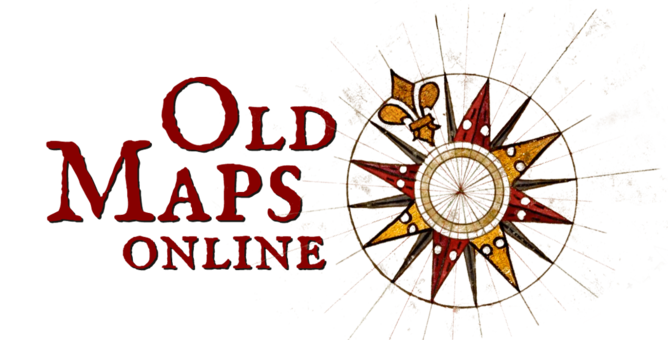 The easy-to-use getaway to historical maps major libraries from around the world. A search engine for historical maps
 - David Rumsey Map CollectionThe historical map collection has over 123,000 maps and images online focusing on North and South American cartographic materials. Historic maps of the World, Europe, Asia, and Africa are also represented.
- Map History : History of Cartography / Tony CampbellAims to be the Internet gateway for the History of Cartography.
- History of Cartography Project / David WoodwardThe Project treats maps as cultural artifacts created from prehistory through the twentieth century. Its major work is the multi-volume History of Cartography series.
- The Sunderland Collection of digitalised maps and atlasesWorld maps, celestial maps, atlases and globes, from the 15th to the 19th centuries.
- World War 2 Special Reports - Allied Geographical Section Southwest Pacific AreaGeographical intelligence on the largely unmapped and underexplored south-west Pacific area (SWPA).
- British Library Map CollectionOne of the largest collections of maps, plans and topographical views in the world. Some 4.5 million items, spread of over 2,000 years.
- History and Geography of Europe and the WorldEuratlas is a website dedicated mainly to the historical geography of Europe.
- Review and Atlas of PalaeovegetationPreliminary land ecosystem maps of the world since the Last Glacial Maximum.
- The Interactive Noli Map WebsiteThe 1748 Map of Rome, by Giambattista Nolli is widely regarded by scholars as one of the most important historical documents of the city ever created.
- Book of Curiosities - Bodleian Library UKBodleian Library acquired an illustrated manuscript, June 2002, of a hitherto unknown Arabic cosmographical treatise, the Kitāb Gharāʾib al-funūn wa-mulaḥ al-ʿuyūn, Book of Curiosities. The treatise contains an unparalleled series of diagrams of the heavens and maps of the earth.
- China Historical GISFree downloads of historical GIS data for China of populated places and historical administrative units between 221 BCE and 1911 CE.
- HKUST Antique Maps of China - Hong Kong University LibraryMaps of China from the late Qing Dynasty-to 1949, thread bound books and other pre-1949 Chinese material, works about China and the Far East by western writers from 1500s to 1949.
- Virtual ShanghaiThe Institut d’Asie Orientale has collected a large number of maps of Shanghai in the 19th-20th centuries. Includes original maps, photographic reproductions, slides and sometimes even Xerox copies.
- Japan Historical GISHistorical boundary data from the 1500s to 1800s for Japan.
- Japanese Historical MapsThe Japanese Historical Map Collection contains about 2,300 early maps of Japan and the World.
- Holy Land MapsThis beautiful collection of ancient maps of the Holy Land is part of a much larger collection. The National Library of Israel.
- Pleiades - Historical geographic informationPleiades has extensive coverage for the Greek & Roman world, expanding into Ancient Near Eastern, Byzantine, Celtic, and Early Medieval geography.
GIS Spatial Software (inc. ArcGIS)
 UniMelb Installation
For PC users UniMelb students can get ESRI ArcGIS for remote installation on personal devices from https://studentit.unimelb.edu.au/software. Click on ArcGIS in the app list and follow the instructions.
Alternatively, use the online UniApps version from any computer operating system. Remember to save your work out of MyUniApps as it deletes everything on logging out.
ArcGIS Training and Tutorials
- Getting Started with GISGet an introduction to the basic components of a GIS. Learn fundamental concepts that underlie the use of maps and geographic data.
- Esri Academy - Explore Our CoursesBrowse by topic, length and type of course.
- Getting Started with ArcGIS StoryMapsLooking to create your first story map? Here's a step-by-step guide to using the ArcGIS StoryMaps builder.
- Full ESRI training catalogueSelect free training courses
- Getting Started with Spatial Analysis - ArcGISSpatial analysis helps you to understand your world. Explore how the six categories of spatial analysis can help you answer geographic questions.
- Getting Started with ArcGIS ProLearn the essential concepts you need with ArcGIS Pro. This course introduces the interface, organization, key capabilities, and ArcGIS Pro terminology.
- Official GDA2020 - AboutAustralia’s Geospatial Reference System static GIS positioning datum
- Going Pro: ArcGIS Pro Essentials for ArcMap UsersAre you an experienced ArcMap user preparing to migrate to ArcGIS Pro? These courses might help.
- ArcGIS Editor for OpenStreetMapAccess, Edit, and Analyze OpenStreetMap Data
- ArcGIS Maps SDK for JavaScriptThis guide describes how to use JavaScript to build compelling web apps that unlock your data’s potential with interactive user experiences and stunning 2D and 3D visualizations.
- ESRI Story Mapping creationEsri Story Maps let you combine maps with text, images and multimedia content to engage your audience. Everyone has a story to tell.

- Quantum GIS
 Quantum GIS (QGIS) is a user friendly free Open Source Geographic Information System (GIS) app. Create, edit, visualise, analyse and publish

A Free and Open Source Geographic Information System
- Download QGISQGIS is available on Windows, MacOS X, Linux and Android.
- Learn GIS basics in 'A gentle introduction in GIS'If you're totally new to using GIS spatial data to make maps this is a good place to start.
- Official QGIS Training ManualThis manual provides a comprehensive introduction to QGIS from the basics of loading and styling data to performing analyses with vector and raster data.
- QGIS Semi-Automatic Classification Plugin (SCP)Sentinel, Landsat, ASTER and MODIS.
It also provides tools for its pre-processing and post-processing of imagery. - QGIS Support for GDA2020To transform existing files to/from GDA2020 install a QGIS plugin supplied by the ICSM. Select the ICSM NTv2 Transformation under Plugins.
- MapboxMapbox Studio is like Photoshop, for maps. We give designers control over everything from colors and fonts, to 3D features and camera angles.
- GRASS - Geographic Resources Analysis Support SystemOpensource software used for geospatial data management and analysis, image processing, graphics/maps production, spatial modeling, and visualization
- Google Earth Pro
 You'll need to download and install a small interface but you get the benefit of a DEM (Digital Elevation Model) under the imagery.
 - SAGA GIS: System for Automated Geoscientific AnalysesSAGA has been designed for an easy and effective, free open, implementation of spatial algorithms.
- Whitebox Geospatial Analytical Tools (GAT)LiDAR support, maps, terrain analysis, geospatial statistics, vector overlay, image processing, similar look and feel to Esri ArcMap
- ILWIS: Integrated Land and Water Information SystemIntegrated Land and Water Information System (ILWIS) is a remote sensing and GIS software which integrates image, vector and thematic data.
- ORFEO: Optical and Radar Federated Earth ObservationFor remote sensing images processing. It can process high resolution optical, multispectral and radar images at the terabyte scale
- Map WrapperOnline tool for geo-referencing raster images. Sponsored by New York Public Library
- Google Earth virtual globe interfaceView maps of the world and find local businesses on an internet web browser.
- Google Maps API FamilyGoogle Maps has a wide array of APIs that let you embed functionality into your own website and applications, and overlay your own data on top of them.
- Google Earth StudioEarth Studio is a web-based animation tool for Google Earth imagery. Satellite and aerial (3D)
- Microsoft BING mapsAn API browser mapper from Microsoft. Different imagery from Google maps and some times more detailed.
- Touch Mapper. 3D printer filesTactile 3D printed maps are a great aid for people who are blind or partially sighted, helping them to orient themselves and to plan routes.
- World Wind JavaWorld Wind SDK for Java is an open-source virtual globe developed by NASA. World Wind . Developers can embed World Wind technology in their own applications
- Map2stlCreate and download 3d printable STL models of any land region on Earth. Includes vertical exaggeration
- Python programming for beginnersDocumentation for how to get started working with Python
- Julia - programming languageThe official website for the Julia Language. Julia is a language that is fast, dynamic, easy to use, and open source.
Some examples of FOSS web mapping APIs for building browser-based apps with HTML and JavaScript.
- OpenLayersOpenLayers makes it easy to put a dynamic map in any web page. It can display map tiles, vector data and markers loaded from any source.
- D3.jsFrequently used for charting but also contains many map examples. It binds data elements to the page's document object model (DOM)
- Polymaps APIDesigned for mashing up map tiles with vector features drawn from GeoJSON and other sources.
- ModestMapsA small, extensible, and free library for designers and developers who want to use interactive maps in their own projects. Core set of features in a tight, clean package.
Web mapping APIs created by commercial software companies have become very popular. In this context, "proprietary" means that the API's source code cannot be downloaded and/or is not permitted to be modified and/or cannot be deployed without paying a royalty.
- Microsoft deverlopment apps including Bing Maps APIsGives developers the opportunity to utilise a range of mapping apps designed to work on Microsoft systems
- Software for UniMelb StudentsSuites of software which The University of Melbourne students are able to obtain access to
- How to import Arc SHP files to AutoCADESRI SHP files store both geometry and attributes. A single shape can have as many as five physical files with the same filename, but different file extensions.
Spatial software support
- Abbreviations and Acronyms in GIS, Cartography, and Remote SensingThis dictionary decodes abbreviations and acronyms maps and websites. These abbreviations or acronyms, therefore, are not necessarily authoritative or standardized.
- Official GDA2020 - AboutAustralia’s Geospatial Reference System static GIS positioning datum
